Advanced Sacs Level Iii :Part2
Dynamic and Fatigue analysis
What you'll learn
real project for dynamic analysis calculation
example for fatigue calculation
the way of doing fatigue analysis
The dynamic analysis calculation method by...
Advanced Sacs Level Iii-Part1
Project drawings and inplace analysis
What you'll learn
example for applying sacs on complete project
eaxmple for inplace analysis and dynamic analysis
example for drawings for a real...
Design of Road Using AutoCad Infraworks 360 and Civil 3D
Detail
Penulis,:
Penerbit,: Autodesk
Bahasa,: English
Durasi,: 3:47:07
Format,: mp4
Ukuran,: 1 GB
DOWNLOAD
Download
ETABS Intermediate Course: Structural Design of RCC Building
Best ETABS Course Online- Live Class Recording Based
What you'll learn
Structural Analysis and Design of RCC Building like Structure as per code provissions using ETABS...
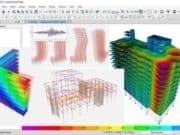
ETABS Course for Building design
ETABS Essentials for Professionals & Students from Basics to Advanced with 20-Storey Building Structural Design Workshop
What you'll learn
Introduction to ETABS (User Interface, viewing options,...
ETABS & SAFE Complete Building Design Course + Detailing
Learn ETABS+ CSI SAFE+AUTOCAD to carry out Structural Analysis and Design of Real World Projects.
What you'll learn
Learn how to import Autocad plans into Etabs...
GIS in QGIS 3 for beginners (project and e-book)
Learn QGIS 3 from scratch
by solving a real life project and get bonus e-book guide
What you'll learn
Using QGIS 3 software from scratch
Working with spatial...
[Intermediate] Spatial Data Analysis with R, QGIS & More
Become an Open source GIS Guru and Tackle Spatial Data Analysis Using R, QGIS, GRASS & GOOGLE EARTH
What you'll learn
Carry out the most common...
QGIS 3.0 for GIS Professionals
Learn how to leverage the power of QGIS to improve your organizations spatial strategy
What you'll learn
By the end of this course students will have...
Hands-On Geospatial Analysis with R and QGIS 3.4
Year of issue: 2019
Manufacturer: packt
Manufacturer website: packtpub.com
Author: Jane Wang
Duration: 2:11:00
Handout Type: Video Tutorial
English language
Описание: Создавайте профессиональные и интерактивные геопространственные и картографические проекты, используя передовые...




![[Intermediate] Spatial Data Analysis with R, QGIS & More](https://sipilpedia.com/wp-content/uploads/2024/10/181-180x135.jpg)
