QGIS 3: from Beginner to Advanced
What you'll learn:
How to work with vector and raster data
How to use spatial web services (WMS, WMTS, WCS and WFS)
Create maps
Create atlas
Perform spatial analysis
Digitize...
QGIS 3 For Absolute Beginners (From Zero)
Learn QGIS From The GIS Expert (Step By Step)
What you'll learn:
How to use basic tools
How to create GIS Layers
How to create your own data
How...
Applied GIS in QGIS in 2021 – Project-based Spatial Analysis
GIS analysis in latest QGIS version: From Beginner to Expert Vector & Spatial analysis in 2021
What you'll learn:
Learn step by step about QGIS, it's...
Site Suitability Analyse Using GIS (QGIS/ARCGIS)
Spatial Analyses with QGIS/ Opensource and free software
What you'll learn
AHP Analysis
QGIS Spatial Analyses
Geoproccessing
Conversion from vector-raster/raster-vector
How to calculate suitability areas
How to make raster analysis
How to...
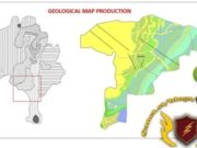
Complete Training Course on Creating a Geological Map | Qgis
A step by step training course in producing a geological map of any given study area for your research or for a client
What you'll...
Advanced QGIS Analysis with AI and Machine Learning
In this course, Gordon Luckett—President of Arrow Geomatics, Inc.—guides you through the advanced GIS Analysis tools available in QGIS, as well as some advanced...
QGIS Crash Course for Beginners
Learn to master a powerful data tool in less than 40 minutes!
What you'll learn:
They will learn the fundamental applications of map-making in QGIS
They will...
PACKT PUBLISHING QGIS PYTHON PROGRAMMING TECHNIQUES
University of OXford & University of camBRiDGE
is a collective term for characteristics that the two institutions share
QGIS Python Programming Techniques
by Erik Westra
Publisher: Packt Publishing
Release...
Skillshare QGIS Cartography-SkilledHares
Title: QGIS Cartography
Publisher: Skillshare
Category: Technology
Size: 3070M
Files: 10F
Date: 2021-05-05
Published: Skillshare
Author: Scott Lussier
Duration: 3h 60m
File Size: 2.61 GB
Download
GeoEducate: Introduction to GIS and Mapping with QGIS
Learn from humanitarian experts about GIS and its capabilities in the field using real cases and data
What you'll learn
Understand GIS concepts and terminology ensuring...


